-
- Baby & Toddler 698
- Electronics 244
- Food & Beverage 1226
- Home & Garden 3664
- Health & Beauty 3419
- Sporting Goods 2096
- Toys & Games 247
- Gifts & Flowers 780
- Clothing 9075
- Councils UK 2626
- Travel 103
- Allerdale News 142
- Ashford News 54
- Buckinghamshire News 6
- Barrow-in-Furness News 85
- Basildon News 22
- Basingstoke and Deane News 10
- Bassetlaw News 32
- Bedford News 1
- Birmingham News 50
- Blaby News 1
- Blackpool News 1
- Bolsover News 71
- Borough of Broxbourne News 9
- Bournemouth News 43
- Bracknell Forest News 2
- Breckland News 54
- Brentwood News 48
- Broxtowe News 69
- Caerphilly News 32
- Cambridge News 36
-
- Bedfordshire News 162
- Charnwood News 202
- Chelmsford News 63
- Cheshire News 87
- Chichester News 3
- Chiltern News 6
- Christchurch News 43
- Colchester News 1
- Cornwall News 17
- Cotswold News 2
- Craven News 3
- Crawley News 43
- Cumberland News 87
- Dacorum News 1
- Derby News 16
- Derbyshire News 72
- Derbyshire Dales News 24
- Devon News 126
- Doncaster News 79
- Dorset News 1
- Dover News 68
- Dudley News 47
- East Devon News 104
- East Dorset News 61
- East Hampshire News 140
- East Hertfordshire News 25
- East Riding of Yorkshire News 309
- East Sussex News 40
- Eastleigh News 17
- Essex News 6
- Exeter News 3
-
- & Other Stories 55
- 11 Degrees 45
- 24S 23
- 4th & Reckless 16
- Abel & Cole 38
- Absolute Snow 58
- Acer 1
- Acotis Diamonds 1
- ADANOLA 52
- Advanced MP3 Players 1
- Agent Provocateur 2
- airconcentre 11
- Aldi 1
- Aldo 15
- Alexandra 31
- Alibris 1
- All-Bar-One 3
- Allerdale Borough Council 142
- allplants 50
- AllSole.com 11
- Almora Botanica 1
- Ambrose Wilson 64
- Ameliorate 12
- American Golf 96
- Anastasia Beverly Hills 41
- Ann Summers 43
- Ann's Cottage 3
- Anthropologie 205
- Antler 52
- Apatchy London 1
- Appleyard Flowers 15
- Apricot 45
- Arighi Bianchi 18
- Armani 1
- Armani Beauty 34
- ARRAN Sense of Scotland 51
- Ashford Borough Council 54
- ASICS 42
- Aspinal of London 13
- Aston Villa 82
- Astrid & Miyu 68
- Avast 1
- Aveda 57
- Avon 27
- Awesome Books 20
- AX Paris 1
- BACKLAxx 27
- BadRhino 72
- bakerdays 35
- Bamboo Clothing 60
- Barrow-in-Furness Borough Council 85
- Basildon Borough Council 22
- Basingstoke and Deane Borough Council 10
- Bassetlaw District Council 32
- Baukjen 56
- Beauty Base 14
- Beauty Bay 89
- Beauty Expert 2
- Beauty Flash 69
- Beauty Works 44
- Bedford Borough Council 1
- Beefeater 34
- Beer52 2
- Bella Italia 21
- Berghaus 44
- Bershka 54
- Betty's 50
- BHS 22
- BiGDUG 33
- Bills 14
- Bimuno 5
- Birmingham City Council 50
- Blaby District Council 1
- Black Circles 3
- Blackpool Borough Council 1
- Blacks 24
- Bloom Boutique 1
- Blue Bay Travel 90
- Boden 26
- Bolsover District Council 71
- Bondara 75
- bonprix 2
- Bonusprint 34
- Boohoo 85
- BoohooMAN 125
- Books2Door 1
- Boomf 9
- Boots 1
- Boots Kitchen Appliances 1
- Borough of Broxbourne 9
- Bose 6
- Bournemouth Borough Council 43
- Boux Avenue 2
- Boxraw 52
- Bracknell Forest Council 2
- Breckland District Council 54
- Brentwood Borough Council 48
- Brewers Fayre 23
- Broxtowe Borough Council 69
- Buckinghamshire Council 6
- Bugaboo 6
- Build-A-Bear Workshop 3
- Bulk 81
- Buyagift 49
- C W Sellors 48
- Cadbury World 6
- Caerphilly County Borough Council 32
- Cafe Rouge 26
- Calendar Club 1
- Calvin Klein 51
- Cambridge City Council 36
- Canterbury 35
- Cartridge Monkey 15
- Carvela 84
- Casetify 2
- Cast in Style 1
- Castore 105
- CCL Computers 27
- Central Bedfordshire Council 162
- CEWE 1
- Charnwood Borough Council 202
- Chelmsford City Council 63
- Chelsea FC 94
- Chelsea Peers 1
- Chemist 4 U 1
- Chemist Direct 47
- Cherry Lane 5
- Cheshire East Council (Unitary) 75
- Cheshire West and Chester Council 12
- Chi Chi London 57
- Chichester District Council 3
- Chilly's Bottles 1
- Chiltern District Council 6
- Chiquito 6
- Chisholm Hunter 24
- Christchurch Borough Council 43
- Christophe Robin 5
- Chunk Of Devon 1
- Circulon 1
- Clare Florist 11
- Clarins 54
- Clinique 79
- Clip Hair 57
- Clove Technology 1
- Club L London 95
- Coach 35
- Coffee Friend 34
- Coggles 12
- Cohorted 6
- Colchester Borough Council 1
- Collectif 16
- Columbia 36
- Complete Care Shop 1
- Converse 21
- Cookology 13
- Coopers of Stortford 1
- Cornwall Council 17
- Cosatto 62
- Cotswold District Council 2
- Cotswold Outdoor 48
- Cotton Traders 37
- Craft Stash 108
- Crafty Nectar 36
- Craghoppers 68
- Craven District Council 3
- Crawley Borough Council 43
- Crew Clothing 59
- Cricut 1
- Crocs 24
- Crocus 68
- CRUISE 121
- Cult Beauty 154
- Cumberland Council 87
- Currys 47
- Curvissa 21
- Cycles UK 7
- Dacorum Council 1
- Damart 7
- Dance Direct 30
- Daniel Footwear 2
- Dare2b 52
- Dartington Crystal 34
- Dash Water 40
- Daye 37
- Decree 1
- Deichmann 1
- Dell Refurbished 1
- Demon Tweeks 3
- Denby 22
- Derby City Council 16
- Derbyshire County Council 72
- Derbyshire Dales District Council 24
- Desenio 48
- Designerwear 105
- Devon County Council 126
- Devon Hampers 3
- Direct Cosmetics 31
- Discount Supplements 4
- DLSB 67
- Dock & Bay 51
- Donald Russell 1
- Doncaster Metropolitan Borough Council 79
- Door Superstore 51
- Dormeo 8
- Dorset County Council 1
- Dover District Council 68
- Dreams 1
- Dudley Metropolitan Borough Council 47
- Dukeshill Ham Company 31
- Dunelm 106
- Durex 20
- Dusk Lighting 24
- DW Aligners 35
- Dyson 10
- East Devon District Council 104
- East Dorset District Council 61
- East Hampshire District Council 140
- East Hertfordshire District Council 25
- East Riding of Yorkshire Council 309
- East Sussex County Council 40
- Eastleigh Borough Council 17
- Easy2Name 1
- Easylife Group 125
- eCatering 55
- Ecco 47
- eFlorist Flowers 5
- Electric Shop 1
- Elemis 33
- ellesse UK 39
- Elvie 18
- EMP 1
- Endura 33
- EQVVS 4
- Erborian 18
- Ernest Jones 84
- Escentual 68
- Essex County Council 6
- Estée Lauder 42
- Eufy Life 41
- Evans 72
- Evans Cycles 53
- Everton Direct 99
- Exante diet 5
- Excel Clothing 6
- Exeter City Council 3
- eyeko 9
- F.Hinds 42
- faace 23
- FACEGYM 23
- FalseEyelashes.co.uk 4
- Farfetch 33
- Farmfoods 1
- Fashion World 42
- Fat Face 1
- Feather & Black 46
- Feel 12
- Feel Good Contact Lenses 3
- FFS Beauty 23
- FFX 11
- Finisterre 50
- Fiorucci 40
- FitFlop 55
- FitTrack 41
- Five Guys 6
- Flamingo Technologies LLC 56
- Flannels 121
- Flexispot 1
- Floom 17
- Flowercard 6
- foodspring 3
- FOREO 3
- Forever New 54
- Foxy Locks 1
- Free People 133
- Free Soul 31
- French Connection 68
- furn 61
- Furniture Village 48
- Furniture@Work 1
- Fy! 37
- G-Star RAW 51
- GAME 39
- Garden of Life 7
- Garden Trading 44
- Garden Trends 26
- Gardenesque 24
- Gardening Direct 110
- Gardening Express 1
- Geepas 45
- Geox 32
- ghd 52
- Gillette 26
- Give Me Cosmetics 5
- GLOSSYBOX 16
- Glow Hub Beauty 20
- Go Ape 4
- Goddiva 2
- Goldsmiths 10
- Golfbase 79
- Graham & Brown Wallpaper 1
- Graham and Green 46
- Great Little Trading Company 40
- Green Chef 5
- Green People 49
- Greggs 2
- Grenade 19
- GRIND 62
- Grow Gorgeous 4
- Grubby 19
- Gtech 1
- Guess 71
- Gym King 72
- Gymshark 37
- H Samuel 63
- H&L Fashions 17
- Habitat 20
- Hamleys 48
- Happy Beds 1
- Harkness Roses 39
- Harmony Store 12
- Harvester 3
- Hawes & Curtis 37
- Heal's 50
- Healthcare Pro 1
- Healthspan 13
- HelloFresh 23
- Helly Hansen 62
- Hershesons 46
- High Street TV 75
- Hive 12
- Hobbs 68
- Hobbycraft 1
- HOKA One One 42
- Holland and Barrett 3
- Homescapes 25
- Hoover 20
- House of Fraser 72
- House of Malt 51
- Hoxton Spirits 5
- HQ Hair 2
- Hunter 1
- Hurleys 1
- Hush 68
-
- I Love Wallpaper 41
- I Want One Of Those 12
- icebreaker 9
- IHG 1
- Industville 23
- Ink & Drop 1
- Innermost 17
- Intimissimi 1
- iRobot 14
- Jack Wills 68
- Jack Wolfskin 1
- JamGolf 17
- Japan Centre 67
- JBL 15
- JD Williams 58
- Jigsaw 95
- JigsawPuzzle.co.uk 36
- JML Direct 1
- Jo Malone London 7
- Joanie 35
- Joe Wicks (The Body Coach) 39
- John Greed 51
- John Lewis 21
- John Smedley 6
- JoJo Maman Bebe 63
- Jones Bootmaker 60
- JONZARA 31
- Joshua James 17
- JSHealth Vitamins 47
- Jura Watches 46
- Just Hype 127
- Just Tyres 78
- Justmylook 80
- Kaleidoscope 82
- Kate Spade 31
- KeepCup 2
- Kerastase 31
- Kickers 40
- Kiddies Kingdom 28
- KIDLY 49
- Kiehl's UK 36
- Kings Will Dream 8
- Kipling UK 8
- Kitbag 81
- Koi Footwear 65
- Kurt Geiger 76
- L'Occitane 19
- LA Muscle 39
- La Redoute 99
- La Roche-Posay 17
- Laithwaites 51
- Lakeland 64
- Lancome 37
- Lands' End 223
- Laptop Outlet 5
- Las Iguanas 41
- Lavish Alice 3
- Le Col 31
- LED Bulbs 16
- Lego 20
- Lenovo 4
- Lights4Fun 60
- Lily's Kitchen 33
- Lindt 3
- Little Life 1
- Liz Earle 76
- LK Bennett 67
- Logitech 23
- London Sock Company 48
- Long Tall Sally 85
- Look Again 21
- LOOKFANTASTIC 22
- Lovecrafts 149
- Lovehoney 7
- Lovell Rugby 1
- Lovell Soccer 1
- Lovely Flora World 1
- lufthansa.com 57
- LullaBellz 1
- Lululemon 37
- Lumin Skincare 18
- M and M Direct 1
- MAC 8
- Machine Mart 1
- Made with Love and Sparkle 1
- Make My Blinds 25
- MANGO 51
- Mankind 2
- Marisota 31
- Marks Electrical 19
- Matilde Jewellery 7
- Mattress Next Day 1
- McDonald's 33
- Merlin Cycles 36
- Merrell 37
- MI Supplies 32
- Micralite 1
- Millie's Cookies 4
- Mint Velvet 30
- Mio Skincare 5
- Missoma 62
- Missy Empire 65
- Moda in Pelle 71
- Molton Brown 41
- Monsoon 8
- Montblanc 41
- Montirex 45
- MOO 2
- Muddy Puddles 50
- Mugler 48
- Murad 52
- Muru Jewellery 1
- Muscle Food 142
- Musicroom 1
- My 1st Years 66
- My M&M's 35
- My Motor World 8
- My Nametags 1
- Mybag.com 4
- MyFlowers 20
- Mylee 114
- Myprotein 122
- Myvegan 4
- N.Peal 40
- Nail Polish 1
- nails inc. 7
- Nando's 7
- National Lighting 16
- Neal's Yard Remedies 35
- Nectar Sleep 36
- Never Fully Dressed 82
- New Balance 58
- New Look 31
- Newcastle United FC 153
- Nikura 1
- Ninja Kitchen 3
- NIO Cocktails 44
- Nisbets 62
- nkuku 16
- No1 Lounges 3
- Noah 1
- Nobody's Child 132
- NordicTrack 9
- Not on the High Street 77
- Notino 1
- NUXE 25
- Oak Furniture Land 54
- Oak Furniture Superstore 40
- Oakley 36
- Oddballs 65
- Office Shoes 74
- Offspring 51
- Olivia & Pearl 41
- Olivia Burton 7
- Olivia's 16
- Omnes 69
- One Pound E Liquid 2
- Online4baby 43
- Only Curls 9
- Open for Vintage 19
- OPI 39
- Optifast 9
- Orelia 67
- Origins 5
- Oscar Deen 6
- Pact Coffee 14
- Party Pieces 6
- Pasta Evangelists 13
- Patch 35
- Patisserie Valerie 37
- PatPat 172
- Paul James Knitwear 36
- Paula's Choice 42
- Penhaligon's 32
- Percival 17
- Perfume's Club 27
- Peugeot Saveurs 13
- Photobook 38
- Photobox Offer 53
- Pia Jewellery 43
- Pink Boutique 66
- Planet X 3
- Playful Promises 55
- Pocket Sport 22
- Pooky 24
- PopSockets 1
- Posturite 16
- Prep Kitchen 28
- Prestige 27
- Pretty Green 51
- Pretty Lavish 62
- Prezzo 18
- Prezzy Box 68
- Primark 36
- Princess Polly 5
- printerinks.com 44
- PrinterPix 82
- ProCook 3
- Protein World 1
- Proviz 42
- Pull & Bear 44
- Pure Collection 32
- PureGym 32
- puzzleYOU 8
- QD Stores 5
- R&R Country 43
- Rachel Galley 1
- Raging Bull Leisurewear 48
- Ralph Lauren 23
- Ramsdens Jewellery 1
- Rattan 64
- Ray-Ban 35
- Razer 1
- Reebok 70
- Regatta 43
- Regis Salon 1
- REN Skincare 47
- Renogy Solar 17
- Ribble Cycles 18
- rinkit.com 45
- Rituals 41
- River Island 67
- Robert Dyas 40
- Rodial 35
- Room to Grow 34
- Routledge 1
- Royal Bathrooms 18
- Royal Doulton 1
- Ryman 39
- SAA 77
- Sage Appliances 18
- Samuel Johnston 7
- Sarah Haran 11
- Sarah Raven 55
- Savage x Fenty 1
- Science in Sport 25
- Scribbler 27
- ScS 51
- Seasalt 3
- Secret Sales 344
- Select Fashion 1
- Shark 4
- Shiseido 36
- Shoe Zone 2
- ShopTo.Net 51
- Silentnight 13
- Sizzling Pub Company 3
- SKAGEN 5
- Skin + Me 1
- Skin Bunny 92
- skyparksecure.com 51
- Slimming World 1
- Snugzy 13
- SOCKSHOP 29
- Sofa.com 2
- Space NK 12
- Speedo 31
- Sportsbikeshop 1
- Spotlight Oral Care 96
- Spreadshirt 1
- Stackers 13
- Standout 28
- SteelSeries 32
- Stone Refurb 1
- Sunday Times Wine Club 51
- Sunglass Hut 14
- Superdry 40
- Superga UK 36
- Sweaty Betty 79
- Swift Direct Blinds 48
- Swinnerton Cycles 17
- Tarte Cosmetics 15
- TGI Fridays 19
- TH Baker 42
- The Cambridge Satchel Company 1
- The Essence Vault 16
- The Fragrance Shop 89
- The Hut 5
- The Jewellery Channel 4
- The Knitting Network 88
- The North Face 40
- The Organic Pharmacy 22
- The Pen Shop 10
- The Royal Mint 6
- The Scotch Malt Whisky Society 3
- The Sports Edit 1
- The White Company 71
- Thriva 3
- Toblerone 26
- Tokyo Laundry 1
- Tommy Hilfiger 51
- TOMS 44
- Too Faced 121
- Topps Tiles 1
- TOWER London 84
- Tredz 38
- Trespass 107
- Trophy Store 18
- TwoBeeps.co.uk 9
- Uniqlo 112
- United Colours of Benetton 1
- Urban Outfitters 144
- Valentte 24
- Value Lights 41
- Vans 4
- Vax 3
- Verified Premier Inn 30
- Vertbaudet 14
- Victoria Plum 1
- Victoria's Secret 47
- Victorinox 1
- Vistaprint 30
- Vital Proteins 7
- Wallpaperdirect 39
- Walls and Floors 17
- Walt Disney World Travel Company 13
- Warwick Castle 9
- Watch Shop 20
- Watch Station 2
- Watchfinder 342
- Waterford 5
- Wayfair 78
- WE 1
- Weekday 48
- Weight Watchers 43
- Weird Fish 61
- White Stuff 93
- Whittard of Chelsea 51
- Wickes 7
- Wildwood Restaurants 13
- Wiltshire Farm Foods 7
- Winfields Outdoors 10
- WOLF & BADGER 81
- Wool Warehouse 1
- World of Roses 36
- Young British Designers 20
- Yours Clothing 105
- YSL Beauty 32
- Yumi Nutrition 24
- Zalando 1
- Zara 1
- Zavvi 7
- Zipvit 44
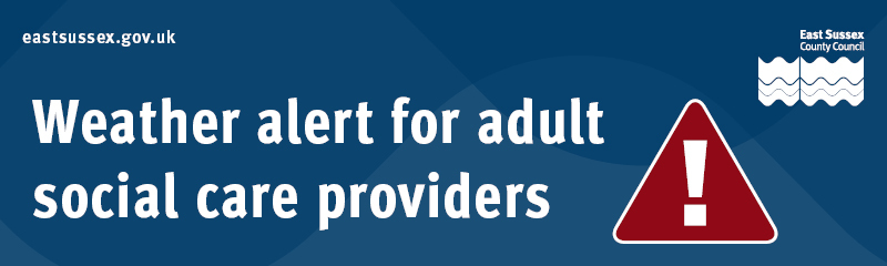
Yellow weather warning issued for the South East
- Category: Councils UK, East Sussex News
- Date: 1714572714
- Brand:
 East Sussex County Council
UK · east-sussex-county-council
View All
East Sussex County Council
UK · east-sussex-county-council
View All
- Category: Councils UK, East Sussex News
- Date: 1714572714
| Yellow weather warning has been issued for the South East |
|
|
|
|
You are receiving this email because you subscribed to receive emails from East Sussex County Council. This email was sent to david.lane@trustedcarcheck.co.uk using GovDelivery, on behalf of: East Sussex County Council · County Hall · St Anne's Crescent · Lewes · East Sussex · BN7 1UE |
|
Text-only version of this email
Yellow weather warning has been issued for the South East
Would you like to view the web page version of this email? _Click here_ [
]
ASC Weather Alert [
]
Dear Provider colleagues,
A Met Office yellow weather warning has been issued for late tonight into early tomorrow.
Thunderstorms are likely at times later this evening and overnight, leading to travel disruption and some flooding.
Main impacts are anticipated to be seen across West Sussex, however, parts of East Sussex may also be affected.
Thunderstorms are expected to move north-westwards across some parts later this evening and overnight bringing spells of heavy rain accompanied by frequent lightning with potential for 15 to 25 mm of rain to fall in 1 or 2 hours in a few places. Hail and gusty winds may also affect a few spots.
What to expect:
* There is a small chance that homes and businesses could be flooded quickly, with damage to some buildings from floodwater, lightning strikes, hail or strong winds
* Where flooding or lightning strikes occur, there is a chance of delays and some cancellations to train and bus services
* Spray and sudden flooding could lead to difficult driving conditions and some road closures
* There is a slight chance that power cuts could occur and other services to some homes and businesses could be lost
[
]
[
] Instagram [
]
[
]
You are receiving this email because you subscribed to receive emails from East Sussex County Council.
This email was sent to david.lane@trustedcarcheck.co.uk using GovDelivery, on behalf of: East Sussex County Council · County Hall · St Anne's Crescent · Lewes · East Sussex · BN7 1UE
Manage Preferences [
]
|
Unsubscribe [
]
|
Help [
]
Show All